Nordic provides a unique one-stop solution for asset tracking applications. We provide the hardware, software, connectivity, and the cloud services. Our low-power nRF9160 SiP has a multimode modem that supports both LTE-M and NB-IoT, as well as GPS. And we have plenty of great applications and samples in our nRF Connect SDK that work out-of-box to support your asset tracking application. Developers also have the freedom to either choose to use our nRF Cloud or their own cloud platform. Either way, you can have access to our nRF Cloud Location Services for power-efficiently obtaining accurate location data.
In this blog, we will compare the power consumption of GPS and nRF Cloud's assisted GPS (A-GPS) feature. While regular GPS downloads the necessary assistance data via satellites (~50 bps), Nordic offers A-GPS to download the assistance data via LTE (~150 kbps). The data is provided in seconds instead of minutes, and the lower power consumption lets asset trackers either decrease in size or increase in battery life. Using real-life measurements from test scenarios outlined in this blog post, we will be able to see how the A-GPS service helps minimize the power consumption in your application. Furthermore, these parameters will be taken into consideration for accurate asset tracking application designs, which will show how A-GPS can help extend your device's battery life.
Parameters
The following table shows the significant parameters to consider with regard to GPS service power consumption evaluation.
| Parameters | Explanation |
|---|---|
| TTFF | Time-to-first-fix. The device firmware is designed to clean up all the GPS satellite data stored in the device and force a cold start, as GPS fix searching will take a longer time from the cold start. This will help to evaluate the potential maximum TTFF under the measurement environment. |
| Floor Current | The floor current consumption when the device is idle. |
| GPS Fix Searching Current | The current consumption when GPS is searching for a fix. |
| A-GPS Handling Period | The period used for handling A-GPS data. |
| A-GPS Handling Current | The average current during the A-GPS handling period. |
We will perform two different tests to obtain all these parameters; TTFF measurements and power consumption measurements. TTFF measurements are designed to evaluate the device GPS service TTFF with and without using assistance data. Power consumption measurements are designed to measure the power consumption during idle state, GPS searching, and A-GPS data handling periods.
TTFF measurements
The GNSS sample in nRF Connect SDK demonstrates all the features related to the nRF9160 GNSS service. It provides an operation mode called TTFF test, which will search for a GPS signal until a fix is obtained and report the time taken to get the fix, ie the TTFF.
nRF Connect SDK samples can use overlay files for setting additional configurations for the firmware. The overlay-ttff-measurement.conf file is created to enable the TTFF test mode and also enable cold start, which makes sure the devices do not contain any GPS data downloaded from the previous search. To enable the A-GPS service, the overlay-enable-agps.conf file is created to allow the device to access the nRF Cloud A-GPS service. The LTE network is only connected when A-GPS assistance data downloading is required. You will also need to follow Securely generating credentials for nRF91 Series devices to provision the device to nRF Cloud to be able to access the nRF Cloud A-GPS data during testing.
overlay-ttff-measurement.conf
# TTFF measurement configurations
CONFIG_GNSS_SAMPLE_MODE_TTFF_TEST=y
CONFIG_GNSS_SAMPLE_MODE_TTFF_TEST_COLD_START=y
overlay-enable-agps.conf
# Enable to use nRF Cloud A-GPS service
CONFIG_GNSS_SAMPLE_ASSISTANCE_NRF_CLOUD=y
CONFIG_NRF_CLOUD_CLIENT_ID_SRC_INTERNAL_UUID=y
CONFIG_GNSS_SAMPLE_LTE_ON_DEMAND=y
For testing regular GPS, build with overlay-ttff-measurement.conf and for A-GPS, build with both overlay-ttff-measurement.conf and overlay-enable-agps.conf.
Connecting the device to serial monitor tools such as LTE Link Monitor will report the Time to fix until successfully obtaining a fix.
[00:00:14.472,656] [0m<inf> gnss_sample: Time to fix: 5[0m
[00:00:14.484,924] [0m<inf> gnss_sample: Sleeping for 120 seconds[0m
Results
| Test Count | 1 | 2 | 3 | 4 | 5 | 6 | 7 | 8 | 9 | 10 | Average |
| Regular GPS TTFF [s] | 28 | 37 | 32 | 26 | 36 | 28 | 20 | 36 | 27 | 20 | 29 |
| A-GPS TTFF [s] | 1 | 1 | 3 | 1 | 1 | 2 | 2 | 1 | 1 | 1 | 1.4 |
| GPS TTFF / A-GPS TTFF | 28 | 37 | 10.6 | 26 | 36 | 14 | 10 | 36 | 27 | 20 | 20.70 |
Power consumption measurements
overlay-low-power.conf file. It includes configurations that disable the logging system used for debugging. This allows us to measure the actual power consumption of the devices during GPS fix searching and A-GPS data downloading processes. This new overlay file is added to the previous regular and A-GPS TTFF measurement firmware configuration in addition to other overlays to generate new firmware files for the power consumption measurement.overlay-low-power.conf#Allow device to achieve lowest power consumption CONFIG_LOG=n CONFIG_SERIAL=n CONFIG_UART_CONSOLE=n CONFIG_AT_HOST_LIBRARY=n
Results
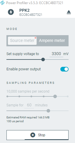
The Power Profiler application recorded the results of three TTFF tests for each reach during the two measurements. The following pictures and tables show the results for the regular GPS searching process and the A-GPS searching process separately.
The regular GPS fix searching process is straightforward as it continues to search for a fix until it eventually obtains one. The table below shows the measurement results for the regular GPS fix searching process.
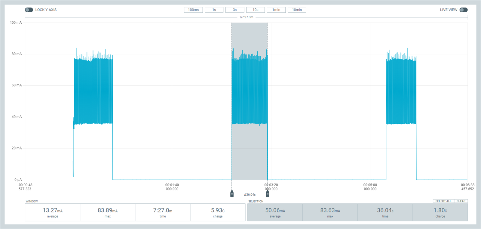
| Regular GPS | Fix searching current (mA) | Fix searching period (s) | Floor current (uA) |
| 1 | 49.81 | 39.10 | 2.19 |
| 2 | 50.06 | 36.04 | 2.14 |
| 3 | 49.95 | 30.00 | 2.17 |
| Average | 49.94 | 35.04 | 2.17 |
The A-GPS TTFF test is slightly different as it involves an A-GPS data handling process, allowing the device to connect to the LTE network and download A-GPS data. With the help of A-GPS data, the device can quickly obtain a fix, resulting in a much shorter GPS fix-searching period.
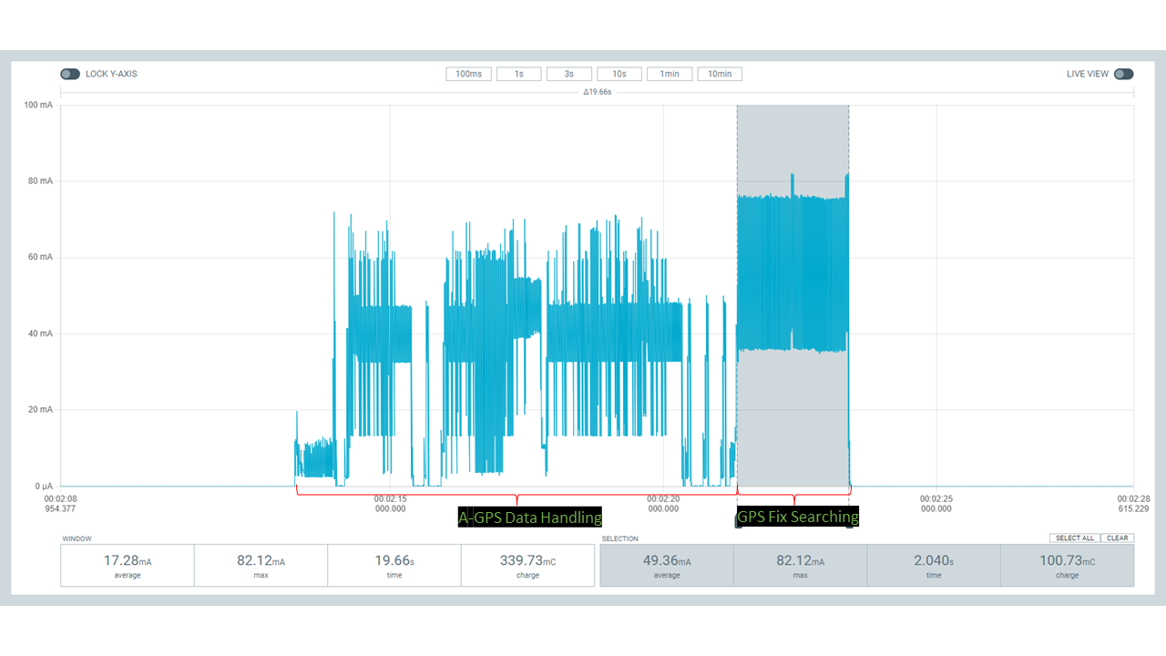
| A-GPS | A-GPS data handling period (s) | A-GPS data handling period average current (mA) | Fix searching period (s) | Fix searching current (mA) | Floor current (uA) |
| 1 | 9.97 | 26.14 | 3.08 | 51.55 | 2.20 |
| 2 | 8.09 | 29.36 | 2.04 | 49.20 | 2.19 |
| 3 | 10.03 | 26.42 | 2.04 | 51.11 | 2.18 |
| Average | 9.36 | 27.31 | 2.39 | 50.62 | 2.19 |
Application power consumption evaluation
To illustrate the difference between A-GPS and regular GPS in an asset tracking application, we assume that the process of obtaining a fix is always the same and will use the average value from the above measurements. As the fix searching current and floor current of A-GPS and regular GPS are quite similar, around 50mA and 2.19uA respectively, we will use these values as the input in the calculations in the next step.For the application design input, we utilize the battery parameters of the Nordic Thingy:91 and assume a total power loss rate of 20%.
We will use different intervals of fix searching, ranging from 10 seconds to 1 day, to cover the needs of various asset-tracking applications. The following table presents the overall input data derived from both application design and previous measurements.
| Application | Measurement | |||||||||
| Fix interval (s) | Battery capacity (mAh) | Battery voltage (V) | Power loss rate | Power voltage (V) | Floor current (uA) | Fix searching current (mA) | Regular GPS TTFF (s) | A-GPS TTFF (s) | A-GPS handling period (s) | A-GPS handling current (mA) |
| 10 | 1350 | 3.7 | 20% | 3.3 | 2.19 | 50 | 29 | 1.4 | 9.36 | 27.31 |
| 60 | 1350 | 3.7 | 20% | 3.3 | 2.19 | 50 | 29 | 1.4 | 9.36 | 27.31 |
| 600 | 1350 | 3.7 | 20% | 3.3 | 2.19 | 50 | 29 | 1.4 | 9.36 | 27.31 |
| 3600 | 1350 | 3.7 | 20% | 3.3 | 2.19 | 50 | 29 | 1.4 | 9.36 | 27.31 |
| 86400 | 1350 | 3.7 | 20% | 3.3 | 2.19 | 50 | 29 | 1.4 | 9.36 | 27.31 |
Using the measurement data, we can calculate the average power consumption for A-GPS and regular GPS. By combining the application battery parameters and fix intervals, we have calculated the runtime of various theoretical asset tracking devices.
The resulting values are shown in the table below.
| Output | ||||||
| Application | Run time (day) | Average electric power (mW) | ||||
| A-GPS | Regular GPS |
A-GPS/GPS run time |
A-GPS | Regular GPS | Power saving percentage | |
| 10s Interval/1350mAh | 3.2 | 1.4 | 2.4 | 51.7641 | 122.6942 | 58% |
| 1min Interval/1350mAh | 11.0 | 3.1 | 3.5 | 15.1920 | 53.7689 | 72% |
| 10min Interval/1350mAh | 94.3 | 21.9 | 4.3 | 1.7665 | 7.6142 | 77% |
| 1h Interval/1350mAh | 546.3 | 125.6 | 4.3 | 0.3048 | 1.3257 | 77% |
| 1day Interval/1350mAh | 8468.3 | 2660.3 | 3.2 | 0.0197 | 0.0626 | 69% |
The excel file attached at the bottom of the blog post, 4621.nRF9160 GPS Application Power Consumption Evaluation.xlsx, covers the calculation process.
Taking a look at the Power saving percentage column in the Average electric power column, A-GPS is capable of saving on average 70.6% more energy than regular GPS, using the same battery. When taking the Thingy:91 battery as an example, we can calculate the actual run time of an application before the battery is drained. The result shows that A-GPS can help asset tracking applications run at least 2.4 times longer, and on average 3.54 times, when we assume a cold start every time.
Closing
This blog explores the use of the nRF9160 SiP for asset tracking applications and how the A-GPS service in nRF Cloud can reduce power consumption and extend device battery life. Our real-world measurements show that A-GPS is much quicker than regular GPS for TTFF. Power consumption evaluation of real-life asset tracking applications shows that the device battery life is on average between 2.4 and 4.3 times longer for A-GPS vs GPS depending on how often you need a GPS fix. This evaluation is intended to demonstrate how A-GPS can help extend battery life compared to regular GPS. Actual GPS performance may vary under real conditions, so it is recommended to use PPK2 for recording and analyzing data specific to an application.
Useful References
- 4621.nRF9160 GPS Application Power Consumption Evaluation.xlsx
- Cloud Services - nordicsemi.com
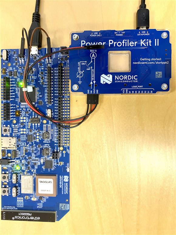
- Getting started with current measurements on the nRF9160
- Using GNSS and GPS assistance | nRF Cloud Docs
- https://ciechanow.ski/gps/
- Field verification of GNSS on the nRF91 Series
- https://en.wikipedia.org/wiki/Time_to_first_fix