What data is used to calculate the AoA tag position

Dear Support Team

I read the <<Bluetooth: Direction finding connectionless locator>> document and saw the log in the picture below. But I don't know which data is the key data to calculate the elevation angle and azimuth angle and how to calculate the tag position. Many thanks.
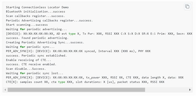
Bluetooth: Direction finding connectionless locator — nRF Connect SDK 2.3.99 documentation (nordicsemi.com)

Parents
  • Hi

    The IQ samples that are used for sampling data come after this CTE[X]: samples count line at the bottom like below:

    IQ sample content : 
    sample[0] = I:5 Q:0
    sample[X] = I:X Q:X

    This is only raw IQ data though and it must be converted into vector form to be reviewed properly. We don't have have any specific sample code showing this, but you can check out this page for information on the various formulas used to translate IQ data between polar and rectangular form. Nordic will not provide a Direction Finding algorithm for you I'm afraid. 

    Best regards,

    Simon

Reply
  • Hi

    The IQ samples that are used for sampling data come after this CTE[X]: samples count line at the bottom like below:

    IQ sample content : 
    sample[0] = I:5 Q:0
    sample[X] = I:X Q:X

    This is only raw IQ data though and it must be converted into vector form to be reviewed properly. We don't have have any specific sample code showing this, but you can check out this page for information on the various formulas used to translate IQ data between polar and rectangular form. Nordic will not provide a Direction Finding algorithm for you I'm afraid. 

    Best regards,

    Simon

Children
Related