What data is used to calculate the AoA tag position

Dear Support Team

I read the <<Bluetooth: Direction finding connectionless locator>> document and saw the log in the picture below. But I don't know which data is the key data to calculate the elevation angle and azimuth angle and how to calculate the tag position. Many thanks.
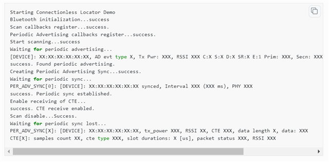
Bluetooth: Direction finding connectionless locator — nRF Connect SDK 2.3.99 documentation (nordicsemi.com)

Parents Reply Children
  • Hi again Tom

    Thank you for explaining! I see. The first (and probably easiest) thing that comes to mind is to use directed advertising and a filter to ensure that the transmitter only transmits to the locator, and that the locator only locate its own tag.

    In the Scanning Module documentation you can see how to set up a filter for Directed advertising beacons. How to set it up on the transmitter side is explained in the CAF advertising module documentation here. If you don't care if other scanning devices can see the transmitter, just adding a filter/whitelist for the transmitter should be sufficient as well I believe, either a whitelist for the device names or a UUID that is advertised from the transmitter can be used.

    Best regards,

    Simon

Related